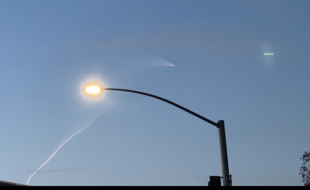
This is the first I have seen like this. A lot of my teaching staff saw it on the way to work, as well. My phone wouldn't let me load the video I have.
Photo
Location
Address
El Dorado Hills, CA
Latitude
38° 37' 40.98'' N (38.628049°)
Longitude
121° 3' 30.5'' W (-121.058472°)
Elevation
160.42894m
Time and Duration
Local Date & Time
2023-12-11 06:50 PST
UT Date & Time
2023-12-11 14:50 UT
Duration
>60s
Direction
Moving direction
From down left to up right
Descent Angle
24°
Moving
Facing azimuth
200°
First azimuth
195°
First elevation
5°
Last azimuth
215°
Last elevation
60°
Brightness and color
Stellar Magnitude
-9
Color
Light Yellow, White
Concurrent Sound
Observation
No
Remarks
-
Delayed Sound
Observation
No
Remarks
-
Persistent train
Observation
Yes
Duration
60s
Length
45°
Remarks
Spiral and then when it was down going straight up, it leveled off with no trail.