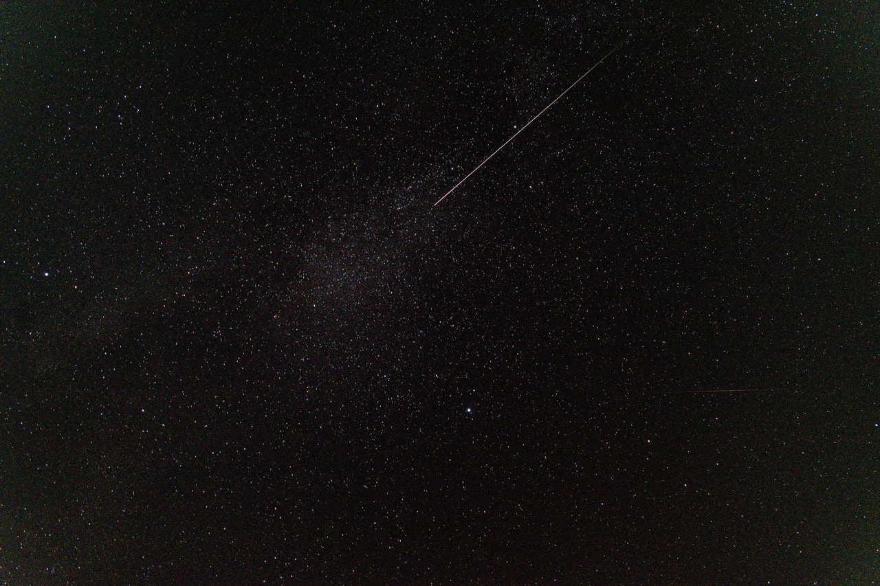
Photo and video showing the smoke trail were taken with a DSLR camera in timelapse mode with a 15s exposure time. Original RAW files are available for all frames of the smoke trail in the video.
Photo
Location
Address
Springdale, AR
Latitude
36° 14' 10.07'' N (36.23613°)
Longitude
94° 14' 0.81'' W (-94.233559°)
Elevation
350.705688m
Time and Duration
Local Date & Time
2023-10-13 21:07 CDT
UT Date & Time
2023-10-14 02:07 UT
Duration
≈3.5s
Direction
Moving direction
From up right to down left
Descent Angle
263°
Moving
Facing azimuth
346.63°
First azimuth
62.88°
First elevation
79°
Last azimuth
258.69°
Last elevation
77°
Brightness and color
Stellar Magnitude
-9
Color
Light Green, Light Yellow, Red, White
Concurrent Sound
Observation
Unknown
Remarks
-
Delayed Sound
Observation
Unknown
Remarks
-
Persistent train
Observation
Yes
Duration
90s
Length
20°
Remarks
Glowing orange/red color with large "puff" at the end