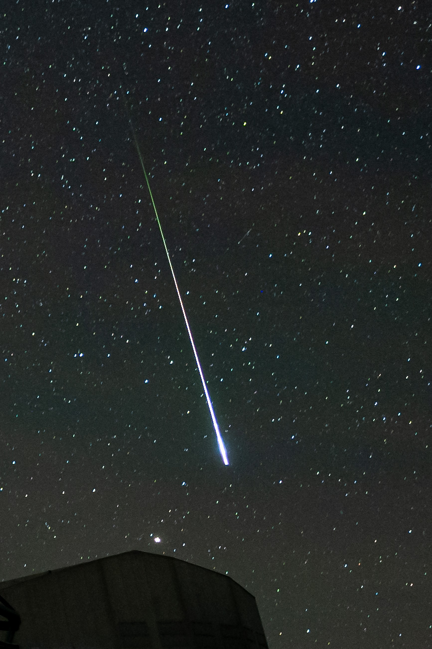
This fireball was captured by accident in a full-night timelapse that I took. I did not personally see it. It's aftermath is visible on the timelapse for about 20-30 minutes.
Photo
Location
Address
, Antofagasta (CL)
Latitude
24° 37' 39.29'' S (-24.627581°)
Longitude
70° 24' 13.35'' W (-70.403709°)
Elevation
2630.334473m
Time and Duration
Local Date & Time
2023-06-22 01:14 -4 time zones
UT Date & Time
2023-06-22 05:14 UT
Duration
?
Direction
Moving direction
From up left to down right
Descent Angle
164°
Moving
Facing azimuth
300.4°
First azimuth
297.3°
First elevation
31°
Last azimuth
299.09°
Last elevation
15°
Brightness and color
Stellar Magnitude
-7
Color
White
Concurrent Sound
Observation
Unknown
Remarks
-
Delayed Sound
Observation
Unknown
Remarks
-
Persistent train
Observation
Yes
Duration
99.99s
Length
-
Remarks
First a straight trail, that then dissolved into a ring