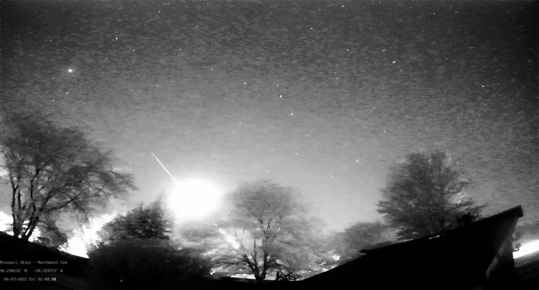
Saw about 3 or 4 reports on AMS and decided to go look it up on my archive. This thing was more than I expected. I couldn't determine a good terminal coordinate for the end point because of the trees.
Photo
Video
Location
Address
Albany, MO
Latitude
40° 14' 54.54'' N (40.248484°)
Longitude
94° 19' 11.17'' W (-94.319769°)
Elevation
276.810333m
Time and Duration
Local Date & Time
2022-06-03 02:02 CDT
UT Date & Time
2022-06-03 07:02 UT
Duration
≈3.5s
Direction
Moving direction
From up left to down right
Descent Angle
132°
Moving
Facing azimuth
304.22°
First azimuth
282°
First elevation
34°
Last azimuth
303.82°
Last elevation
7°
Brightness and color
Stellar Magnitude
-8
Color
B&W Camera Used
Concurrent Sound
Observation
No
Remarks
-
Delayed Sound
Observation
No
Remarks
-
Persistent train
Observation
Unknown
Duration
-
Length
-
Remarks
-
Terminal flash
Observation
Yes
Remarks
Flash was not terminal but occurred about midway through the flight path. See image and video